Throughout the township of Bonnie Doon, there are a total of 12 sightseeing locations with signboards. Each signboard will tell you some of the history of Bonnie Doon, and also have a QR code to direct you to these pages on our website. These codes when scanned with a smart phone or tablet provide additional informative text/images that create an interactive walk throughout the history of the Doon. You can follow along the history here on our website or better yet, get out on the trail and take a wander through Bonnie Doon – follow the signs that go along with along with these pages. We hope you enjoy your walk back in time.
The Goods Shed at the Bonnie Doon Railway Station
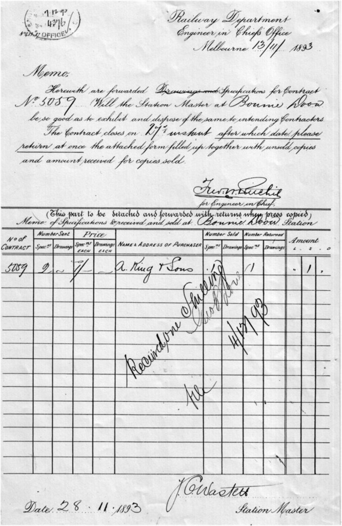
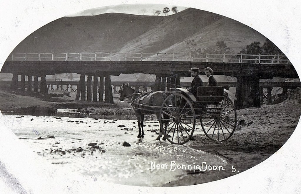
In the early years of settlement, carriers transported goods from Melbourne to Bonnie Doon by horse drawn carts. This mode of transport was tedious and quite dangerous. In 1885, tenders were called for works on a railway line between Yea and Mansfield much to the delight of local farmers who envisaged easier transport of their produce to the city and better supplies from Melbourne to their homes and stores. The Yea to Mansfield line was constructed in stages, completing the first stage to Molesworth in 1889 and finishing in the last stage to Mansfield in October 1891. Incidentally, it was the same year Doon changed its name to Bonnie Doon.

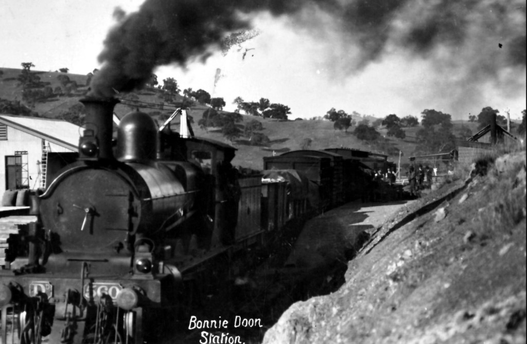

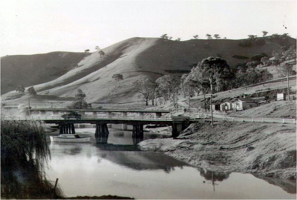
Bonnie Doon’s railway station served the township for more than 60 years until Melbourne’s growing population demanded an ever-increasing supply of food, which could easily be supplied by the Goulburn Valley, if it had adequate irrigation water. In order to ensure a dependable water source for that purpose, it was decided to enlarge the Sugarloaf Reservoir (renamed Lake Eildon). This of course, meant flooding the Bonnie Doon township and part of its railway line. Subsequently, houses were moved to higher ground and the works on a rail line diversion, which included the building of a new rail bridge, commenced. In 1955, the rail bridge across the now flooded old township and farming land was completed with the first train moving across.

The rail service continued for 23 years, to be replaced by bus services for public transportation and by trucks for hauling stock and other freight. Following closure of the line in 1978, dismantling occurred very quickly, allowing the track to revert back to nature and becoming overgrown. In 1999, after $65.000 of Government funding financed the construction of handrails and a path, the Bonnie Doon Rail Bridge was opened as a walking and cycling trail.
In 2004 the Mitchell, Murrindindi and Mansfield Shires developed a Business Plan for the ‘Goulburn River High Country Rail Trail’ covering the entire line from Tallarook to Mansfield. After securing funding of $14M from federal and state coffers, the construction work of one of the longest rail trails in Australia began and was completed in 2011.
This walk crosses the traditional lands of the Taungurung people and the Bonnie Doon Community acknowledges them as the traditional owners of the land. We also pay our respects to all Aboriginal and Torres Strait Islander people.
